
The Sandakphu trek route is one of the most scenic and culturally rich trekking trails in India. Located in the Singalila Range of West Bengal, this trek follows the India-Nepal border and leads to Sandakphu (11,930 ft.), the highest point in the state. What makes this route special is its gentle gradient, well-marked path, tea-house accommodations, and unmatched Himalayan views.
This complete itinerary explains the Sandakphu trek route step by step, so you know exactly what to expect each day on the trail.
Sandakphu Trek Route Overview
- Start Point: Manebhanjan
- End Point: Gorkhey / Srikhola
- Maximum Altitude: 11,930 ft (Sandakphu)
- Total Distance: ~45-50 km (Sandakphu only)
- Duration: 6-7 days
- Difficulty: Moderate
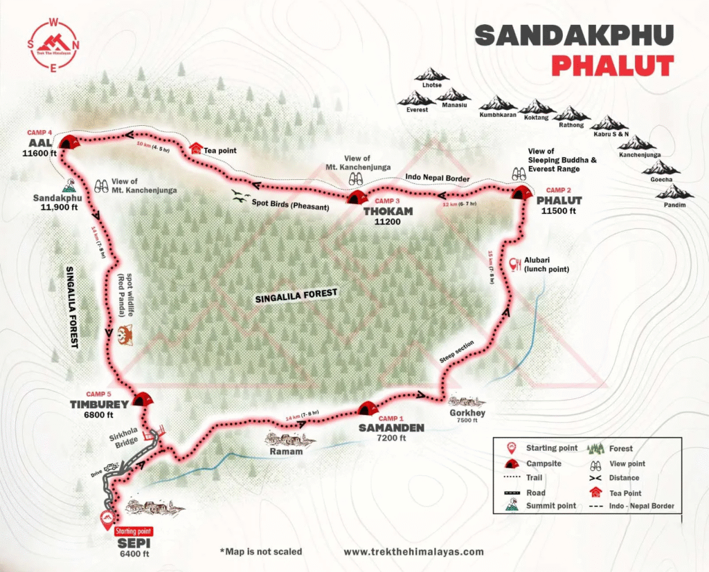
Classic Route:
Manebhanjan – Tonglu – Kalipokhri – Sandakphu – (optional) Phalut – Gorkhey
Sandakphu Trek Route – Day-by-Day Complete Itinerary
Day 1: NJP / Bagdogra to Manebhanjan (Drive)
- Drive Distance: ~95 km
- Time: 4-5 hours
- Altitude: 7,054 ft
Manebhanjan is the traditional starting point of the Sandakphu trek route. This small hill town near Darjeeling serves as the base village where permits are checked and local guides are assigned.
- Terrain: Road journey through tea estates and hill roads
- Stay: Guesthouse
- Note: Trekking officially begins from here
Day 2: Manebhanjan to Tonglu
- Trek Distance: ~11 km
- Altitude Gain: 7,054 ft. – 10,130 ft.
- Time: 6-7 hours
This is the first trekking day and one of the steepest sections of the Sandakphu trek route. The trail climbs steadily through pine, fir, and rhododendron forests.
- Terrain: Forest trail, gradual to steep ascent
- Highlights: First views of Kanchenjunga if weather is clear
- Stay: Trekker’s hut / lodge at Tonglu
Day 3: Tonglu to Kalipokhri
- Trek Distance: ~12 km
- Altitude: ~10,400 ft
- Time: 6-7 hours
The route passes through Meghma village, where the trail briefly enters Nepal. This cultural crossing is a unique feature of the Sandakphu trek route. The day ends at Kalipokhri, known for its sacred black lake.
- Terrain: Rolling ridges, forest paths
- Highlights: Kalipokhri Lake
- Stay: Lodge / trekker’s hut
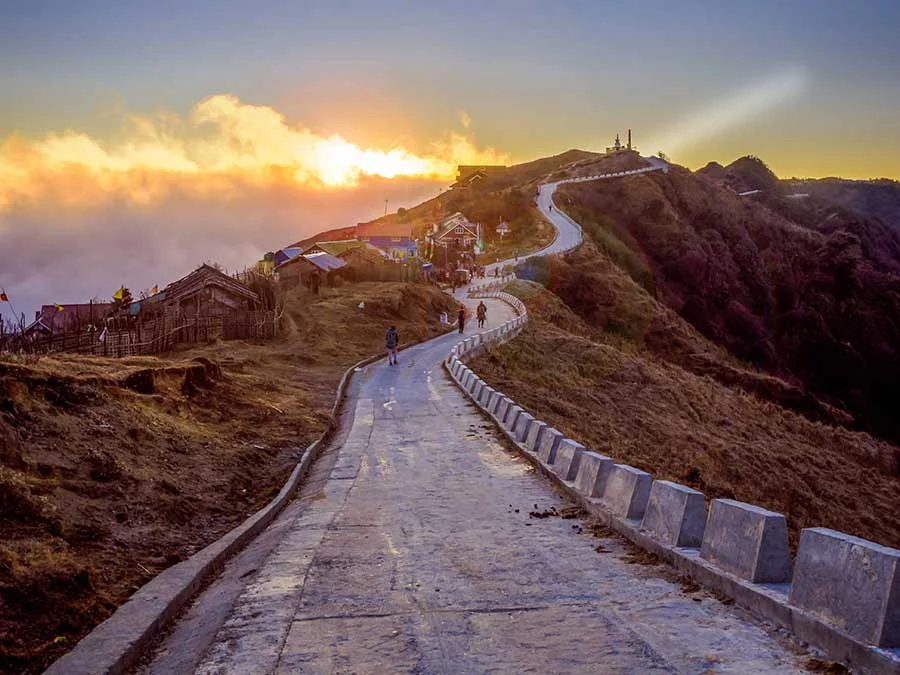
Day 4: Kalipokhri to Sandakphu
- Trek Distance: ~6 km
- Altitude Gain: 10,400 ft – 11,930 ft
- Time: 4-5 hours
Despite being short in distance, this is the most challenging ascent on the Sandakphu trek route. The trail is steep and can be snowy in winter.
- Terrain: Steep ascent, open ridge
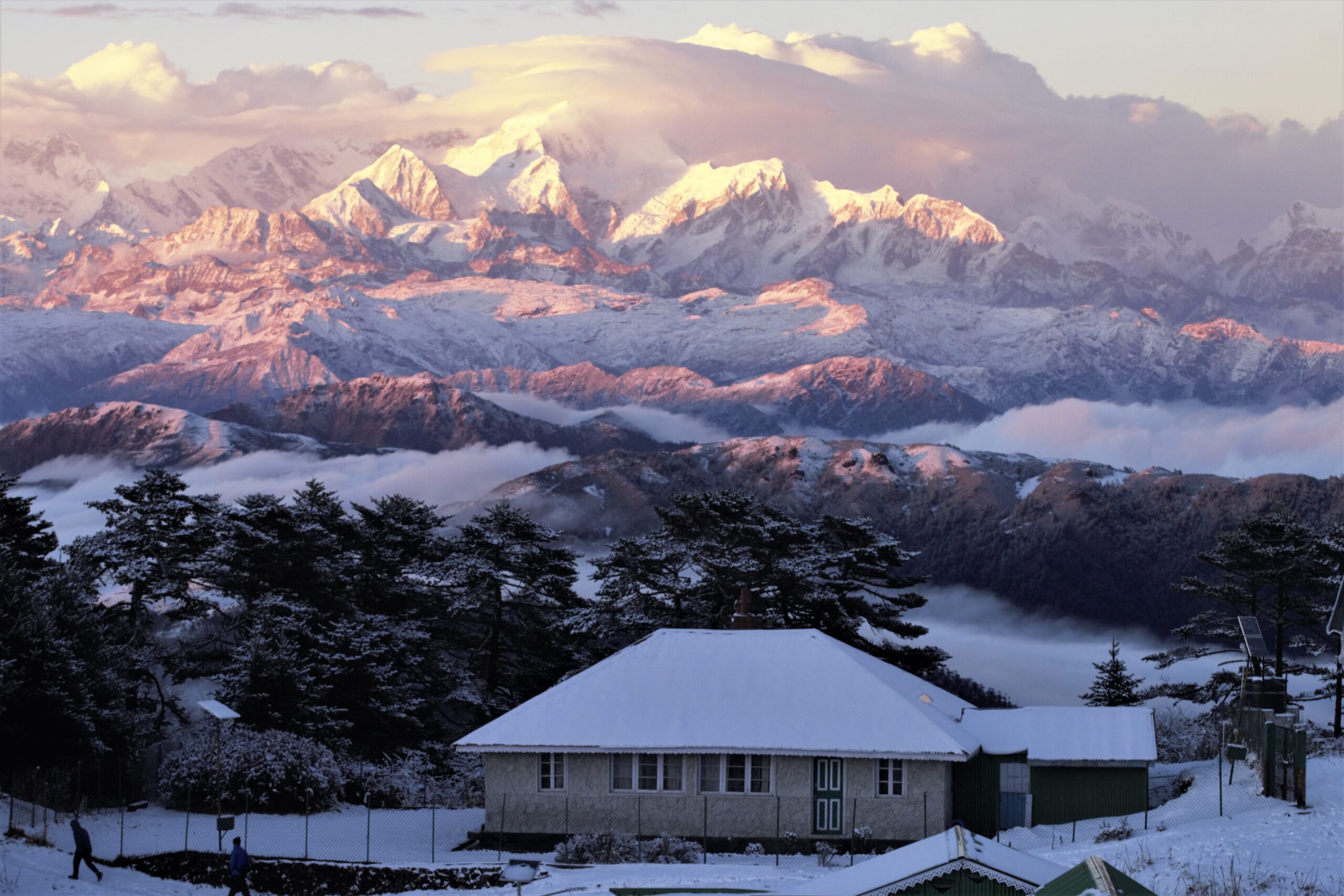
- Highlights: Sunrise views of Kanchenjunga, Everest, Lhotse, Makalu
- Stay: Lodge at Sandakphu
Day 5 (Option 1): Sandakphu to Phalut (Extension Route)
- Trek Distance: ~21 km
- Altitude: ~11,811 ft.
- Time: 7-8 hours
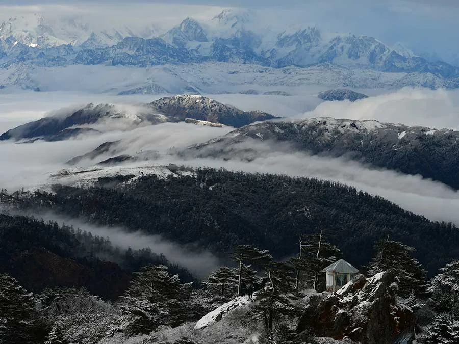
This day is included if you choose the Sandakphu-Phalut trek route. The walk follows a high-altitude ridge with continuous mountain views–considered the most scenic day of the trek.
- Terrain: Gentle ridges, long distance
- Highlights: Panoramic Himalayan skyline
- Stay: Trekker’s hut at Phalut
Day 6: Phalut to Gorkhey
- Trek Distance: ~15 km
- Altitude Loss: 11,811 ft – 7,900 ft
- Time: 6-7 hours
The trail descends steadily through forests into Gorkhey, a beautiful Himalayan village surrounded by streams and green fields.
- Terrain: Downhill forest trail
- Highlights: Traditional village life
- Stay: Guesthouse
Day 7: Gorkhey to Srikhola – Drive Back
- Trek Distance: ~4 km
- Drive: Srikhola to NJP/Bagdogra
The trek officially ends at Srikhola, followed by a return drive.
Alternative Sandakphu Trek Route
- For trekkers with limited time:
- Skip Phalut
- Descend directly from Sandakphu to Srikhola
- This reduces the total distance to ~45 km.
Sandakphu Trek Route in Winter (December-February)
- Snow common between Kalipokhri and Sandakphu
- Trail remains same but requires microspikes
- Phalut extension may be skipped in heavy snow
- December offers quiet trails and clear views
Best Time for the Sandakphu Trek Route
- April-May: Rhododendron bloom
- October-November: Best mountain views
- December: Snow trekking experience
Difficulty & Fitness Required
- Grade: Moderate
- Daily walking: 5-7 hours
- Key challenge: First-day ascent and long Phalut day
- Suitable for beginners with regular walking practice.
Why the Sandakphu Trek Route Is Special
- Tea-house trek (no camping)
- India-Nepal border experience
- Four 8000m peaks visible
- Wide, well-defined trail
- Cultural villages and monasteries
FAQs
The complete Sandakphu trek route covers approximately 45–50 km when done till Sandakphu summit. If you extend the route to include Phalut, the total distance increases to around 65–75 km.
Yes, the Sandakphu trek route is considered beginner-friendly. The trail is well-marked, gradually ascending, and offers tea-house accommodation, making it ideal for first-time trekkers with basic fitness.
No, the Sandakphu trek route remains the same in December. However, snow near Kalipokhri and Sandakphu can make sections more challenging, and the Phalut extension may be skipped depending on weather conditions.
The most challenging part of the Sandakphu trek route is the steep ascent from Kalipokhri to Sandakphu. Though short in distance, it involves a sharp climb and can be slippery during winter or snowfall.